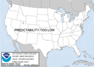
On Saturday August 2, 2008 North and Central Alabama experienced some unexpected severe weather. There were only about four storms that moved southward from the Tennessee Valley down into Central Alabama but the packed quite a wallop. There were numerous reports of damaging winds and large hail. There was even a tornado warning or two.
This is how it all got started:
Here are the reports from the National Weather Service:
From Huntsville CWA
Highlights:
1.75" (golf ball) hail at Gurley in Madison County 3:14 p.m.
1.00" (quarter) hail covering the ground and stripping leaves from trees 5 miles east of Meridianville in Madison County 3:48 p.m.
1.75" (golf ball) hail covering the ground at Whitesburg and Airport Rd in Huntsville in Madison County 4:38 p.m.
1.75" (golf ball) hail damage to cars in south Huntsville 4:45 p.m.
1.75" (golf ball) hail in Green Hill in Lauderdale 5:00 p.m.
1.75" (golf ball) hail in Fairview in Cullman 5:00 p.m.
Trees and power lines down on CR 33 near Green Hill in Lauderdale damaging multiple houses that were under construction. Lumber was blown into road. 5:15 p.m.
From Birmingham CWA
Highlights:
1.75" (golf ball) hail 4 miles ENE of Cedar Bluff in Cherokee County 5:02 p.m.
1.75" (golf ball) hail at Samantha in northern Tuscaloosa County 6:24 p.m.
1.25" hail at Lincoln in Talladega County at 7:39 p.m.
Trees and power lines blown down in 4 mi NNE of Dora in Walker County 6:05 p.m.
Trees down on residence in Ohatchee in Calhoun causing entrapment 6:53 p.m.
Trees down on residence in Lincoln in Talladega 7:58 p.m.
Power lines down at Vincent High School in Shelby County at 8:14 p.m.
Trees and power lines down at Childersburg in Talladega at 8:16 p.m.
---numerous other reports of trees down on roads---
Chief Meteorologist James Spann of ABC 33/40 in Birmingham has put together an excellent team of Skywatchers. These Skywatchers and other viewers captured and submitted some amazing images of the storms from Saturday August 2, 2008.
David Drummond / Tommy Howell - Tuscaloosa lightning
Josh - Tuscaloosa lightning near Shelton State
Chris Brown - Oxford mammatus clouds
James Payne - Etowah County damage
Erin Garrad - Southside damage
Clouds, lightning and hail images from all over Alabama
Stephan Frank - Munford area lightning and mammatus clouds
Lightning south of Tuscaloosa
Kelli and Troy Guthrie - Ohatchee damage, flooding, lightning, and clouds
Brandon Harris - Jacksonville lightning and mammatus clouds (very good)
Michelle Miklik and Jamey Parker - Warrior mammatus clouds
Melinda and Dave Millican - Northside hail
Nathan and Maggie Moore - Samantha hail (nice pics)
Tony Owens - Cedar Bluff, Cherokee County hail
Tracy - Oakman, Walker County hail
---
As for me... I was at home when the storms began firing in North Alabama. I took the above time lapse video from my yard. My sons were gone for a few hours with their mother to a wedding. When they returned we tried to follow the storm that produced golf ball size hail in Fairview. We saw some cloud to ground lightning as we drove south on US 31 into Blount County, but we saw no hail or other severe weather. All was not lost though as we stopped and ate barbecue sandwiches, slaw, baked beans, and fries at the Top Hat BBQ in Blount Springs!
---
Sunday Weather Xtreme: A Nice Day for a Race
-
Much of the week ahead will be dry with rain not returning until late
Friday.
5 hours ago
No comments:
Post a Comment