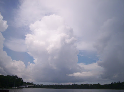
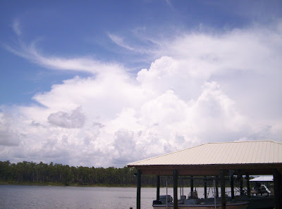
Monday, June 30, 2008

What is a Microburst?


NOAA photo

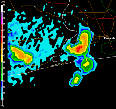
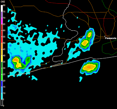
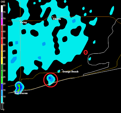
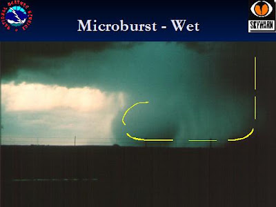
A microburst is a "localized column of sinking air, producing damaging divergent and straight-line winds at the surface", according to Wikipedia. There are two types: wet and dry microbursts. The term was coined by the famous tornado and severe weather researcher Theodore Fujita to describe the rapid downward burst of air that accompanies thunderstorms and fans out in an area of up to 2.5 miles in diameter.

The NWS in Norman, OK defines a microburst as, "A small, concentrated downburst affecting an area less than 4 kilometers (about 2.5 miles) across. Most microbursts are rather short-lived (5 minutes or so), but on rare occasions they have been known to last up to 6 times that long."

A thunderstorm which produces a wet microburst is not necessarily "severe", meaning that it doesn't necessarily have to produce 3/4 inch hail or contain winds of 58 miles per hour or greater. Winds in a microburst can be anywhere from 45 to 150 miles per hour.

Here is an interesting article from the International Herald Tribune that describes how the phenomenon of microbursts was discovered and how that discovery has resulted in new safety measures:

"Ted Fujita, the late Japanese researcher, was the first to propose the existence of the microburst, which he called a "downburst." The theory arose as he flew over a remote Siberian forest in a helicopter in 1972. Below were thousands of large trees blown down for hundreds of square miles. His Russian hosts told him it was probably a giant tornado. But Fujita knew better. The trees were blown outward from a single point. A tornado moves along a path. Fujita, already famous in meteorology as the man who developed the "F scale" for tornado strength, was brought into the world of airline crashes in 1975 when an Eastern Air Lines official, Homer Mauden, asked him to review data from the mysterious crash of an Eastern Boeing 727 at John F. Kennedy Airport in New York on June 24, 1975, which killed 112 people. Fujita's verdict was clear: It was a downburst."
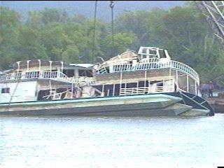
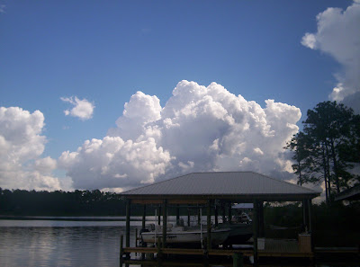

WHNT Photo


Huntsville, Alabama has been hit by deadly microbursts before. Perhaps the worst was on July 7, 1984. There is an excellent article by WHNT 19 reporter Steve Johnson on that subject here.


"July 7th, 1984, was a lot like any other mid summer day. It was partly cloudy, hot, humid, and a good day to be on the river. But on that day 22 years ago, a thunderstorm popped up in the late morning hours, and 11 people died on the Tennessee River because of it. In large part, the deaths were caused by a microburst from the storm - a strong wind, that lasted a few deadly seconds."


Finally, here is an excellent video in which Warning Coordination Meteorologist, Dan Gudgel, National Weather Service, Hanford, CA describes a microburst and it's cause and effect. Video of a microburst in progress and it's assocaited damiage is included in this clip.


Sunday, June 29, 2008

More video from the air show


WAAY TV is reporting the following:
Airport officials have confirmed that one person, 5 year-old Aaron Miller of Athens is dead after a microsburst hit the Air Show this afternoon. Witnesses say several VIP tents, including the City of Huntsville's tent, and the main announcer's stand were picked up off the ground and overturned. Twelve additional injuries, including lacerations and fractures have also been confirmed.

Video from the airshow

A strong thunderstorm flipped several tents that had been set up for VIP spectators at the Huntsville Air Show 2008. There are several injuries.

Miscellaneous reports from the air show tragedy...


A five-year old boy was killed when an A/C unit fell out of a window & landed on the child.

People in one tent took cover as the winds took the surrounding fence down...took cover underneath the tent. They were literally holding the tent down from underneath...

1 death and 12 injuries confirmed....per WHNT 19...

Most of the people injured were not life threatening per WAFF...

Airport officials say they will release no more info today and the news conference lasted 3 minutes

Heard same on WHNT: 12 at Huntsville Hospital...2 children, 4 under 18, & 6 adults. All injuries are bumps/bruises/ broken arms, etc...

Entire Madison Police Dept was called in to cordon off the entire perimeter of the damage area...

Official report by NWS Huntsville:
HUN: 3 Ssw Madison [Madison Co, AL] emergency mngr reports TSTM WND GST of M48 MPH at 02:05 PM CDT -- *** 1 fatal, 12 inj *** microburst produced a 41kt gust at the khsv asos. tents and aircraft at the huntsville airshow were overturned causing a fatality and several injuries.

Weather tragedy in Huntsville, Alabama.

From WAAY Huntsville:

"At least one person is confirmed dead after a severe thunderstorm hit the Air Show this afternoon. Witnesses say the VIP tents and main announcer's stand were picked up off the ground and destroyed. Nine additional injuries have been confirmed."

From the Huntsville Times:

At least six people are injured after heavy winds uprooted a large tent this afternoon at the Huntsville Air Show at Huntsville International Airport. Emergency workers are treating the victims, which include two children. The tent, which is about 50 yards in length, belongs to the Huntsville-Madison County Airport Authority. Times reporters at the show said a generator fell on one person, whose condition is likely serious. Minor injuries include cuts and contusions. A meteorologist with the National Weather Service Huntsville office said winds reached 48 miles per hour during the storm, which cancelled the air show.

Breaking news

Huntsville television stations are reporting several injuries at the Huntsville International Airport from high winds that struck around 2 p.m. at the air show there that featured the Blue Angels. Six people were injured according to The Huntsville Times, one seriously. A news conference is scheduled for 4 p.m.


2:05


2:10


2:14

Cookout with James

Thank you to James Payton and his wife Tonia for inviting me to his home for a very nice cookout last night. He has a wonderful view of Monte Sano from a nearby ridge. It was great meeting the folks there including Keller Watts of WAAY Channel 31 in Huntsville. Keller does the weekend weather broadcasts for Channel 31. He, James, and I discussed severe weather coverage, the business of broadcast meteorology, storm chasing, and a host of other weather-related topics. We were also treated to a good view of lightning strikes, cumulonimbus towers, and a passing thunderstorm over Monte Sano.


Saturday, June 28, 2008

North Alabama skies this weekend


Today as I drove towards Huntsville on I-565, I saw the Blue Angels getting ready for their airshow at the Huntsville International Airport. Since there was a several-mile long traffic jam on the interstate I took a few quick pictures out of my window. Maybe one of my friends who attended will share some photos. I am really looking forward to a cookout this evening with friend and fellow weather blogger James Payton.


Last night the boys and I were playing some kickball out in the yard. A nice rain shower moved through dropping .14" of rain and the rainbow pictured above. The rainbow was a bright spot in an otherwise rough day.

Thursday, June 26, 2008

Driving home


On my way home today there were some really pretty cumulus clouds, but they didn't develop into many storms in the area. It was just a nice typical drive through the hills of North Alabama on a late June afternoon.

Under the weather

I have been battling some kind of bad sickness since Saturday night, probably at least a bad sinus infection, and possibly more. Between that and the fact there hasn't been a lot happening lately with the weather in my area, I have been quiet on here. I will be getting back to more consistent updates soon.

There were actually quite a few active storms, some severe, in Alabama yesterday. As always, they were covered well by J.B. Elliott, James Spann, and ABC 33/40 Skywatchers over on Alabamawx.com.

Monday, June 23, 2008

Good Day Sunshine

The weather is quiet and I am under it :( ...

It's a nice day for any of you who can get out in it!


Saturday, June 21, 2008

Cool weather and dust devil damage

This morning ended a streak of three consecutive days with lows in the 50's at my location in North Alabama. Even so, the low on this, the official first day of summer, was a comfortable 63 degrees.

Here's another unusual item from yesterday Russell County in East Alabama from the NWS Birmingham:

2 Nnw Uchee Creek in Russell Co, AL - emergency mngr reports NON-TSTM WND DMG at 02:40 PM CDT -- portions of a mobile home roof were destroyed from what witnesses described as a large dust devil. firefighters arriving on scene described debris swirling over 100 feet in the air.

Thursday, June 19, 2008

The Mad Meteorologist

Do any of you recognize this guy?

The mad meteorologist, Mr. James, shows us his TV weather office as Summer Xtreme 2:52 kicks off on June 9, 2008!


Part 2

Part 3

Part 4

Part 5

Part 6


Wednesday, June 18, 2008

Novermber 8, 1989 Alabama Storm Chase


These videos run from just before 5 p.m. until just after 7 p.m. on Novermber 8, 1989. I was student at the University of Alabama and decided to chase storms just before sunset in West Alabama. I began in Tuscaloosa and drove south to near the Havana Junction and Moundville communities in Hale County.

When I left Tuscaloosa we were about to be placed under a tornado watch and by the time the storm approached my location Greene County was placed under a tornado warning and Hale county was placed under a thunderstorm warning.

In this video you can listen to James Spann on WBRC 6 and NOAA Weather Radio from Birmingham. You will see lightning, intersting cloud formations, small hail, and torrential rain. As an added bonus you can hear the audio from a the television news, sports, and commercials from that day.

Earlier that morning two tornadoes (F0 and F1) touched down in Houston County. There was damage in the north part of Dothan.

According to the NWS, the first tornado resulted in: "One home had its awning blown off and part of a church was damaged. Trees were uprooted." As for the second Dothan tornado, "2 homes were destroyed and 50 car windows were blown out. 2 businesses received major damage and one had moderate damage. One office complex sustained major damage. Hundreds of trees were blown down."

Exactly one week later, one of the most deadly Alabama tornadoes ever ravaged Huntsville.

Part One"


Part Two:

Cool change

It was refreshing to wake up with cool fresh air blowing through my window this morning. My low was 58 but several parts of North Alabama were between 49 and 55.

Monday, June 16, 2008

Thunderstorm Over Perdido Bay, Alabama 6/13/08

This is a time lapse video of a thunderstorm over Perdido Bay on the Alabama/Florida Gulf Coast between 9:30 and 10:00 a.m. CT on June 13, 2008.


Sunday, June 15, 2008

Nature put on a show!


The boys and I enjoyed watching nature put on some awesome light shows today in Baldwin County, Alabama. The best one was around midnight as we were watching a movie. The movie had to be paused as we witnessed an amazing storm.

Friday, June 13, 2008

Hot and humid with scattered storms

Early morning:
Isn't that title pretty much the forecast every day in Alabama in June and July?

At 6:40 a.m. the temperature in southeast Baldwin County is 73 with a dewpoint of 70. There are some storms to our southeast in the Gulf.

1:30 p.m. update:
Storms blew up this morning all around us. I enjoyed watching the cumulonimbus towers while we were fishing. I took several pictures (below) and posted them occasionally throughout the morning. Very little rain occurred at our location, but some areas nearby had very heavy rain and cloud to ground lightning. There was a nearly constant rumble of thunder from around 9 a.m. until after noon.

The boys are catching little pinfish like they are going out of style. Matthew also caught a catfish. The fish started really hitting our bait (red hot dogs) when the storms approached, and they haven't stopped yet. I got to finish up cooking and get back to the guys.

5 p.m. update:
Storms have been pulsing around us all day but we had just enough rain to bump the humidity up a few notches. The dewpoint has been around 72 or 73 all afternoon with temperatures in the mid to upper 80's. The weather has been ideal for fishing, though. The boys have caught literally dozens of fish; mostly pinfish and a few catfish.


8:08 p.m.


7:44 p.m.


7:34 p.m.


7:11 p.m.


5:21 p.m.


4:15 p.m.


3:06 p.m.


2:55 p.m.


2:52 p.m.


12:40 p.m.


11:50 a.m.


11:49 - Dying thunderstorm


11:20 a.m.


10:57 a.m.


10:54 a.m.


9:55 a.m.


9:54 a.m.


9:48 a.m.


9:44 a.m.


9:44 a.m.


9:31 - looking ESE towards Perdido Bay and Pensacola


9:31 a.m.


8:57


9:00 a.m.


7:21 a.m.


7:21 Mobile Nexrad - My location is the small circle; the cloud above is in the large circle.

Thursday, June 12, 2008

Today from Baldwin County, Alabama

The boys and I are having what I consider a nice break from everything today in lower Alabama. We are fishing in the backwaters of Spring Branch, which is just off Arnica Bay and the intracoastal waterway near the Alabama-Florida border. I will post photos here periodically through the day. A huge "thank you" to one of the nicest guys I know for giving me, and especially my boys, this great opportunity.


8:21 p.m.


8:13 p.m.


7:49 p.m.


6:44 p.m.


6:40 p.m.


5:56 p.m.


4:54 p.m.


2:32 p.m.


02:31 p.m.


2:07 p.m.


2:08 p.m.


Thunder to the northeast at 1:31 p.m. Temp 88, Dewpoint 70.


1:30 p.m.


Convection is really kicking in at 1:03 p.m.


1:03 p.m. radar shot


11:56 a.m.


This is what the above cloud looked like on radar. Our location was the red dot. The storm in the photo above is the one with the small yellow dot just on the Florida side of the Perdido River.


Lots of puffy cumulus clouds this morning. It is very warm and humid!


This is where we are.


9:30 a.m. temperature is 86. The depoint is 70.
Newer Posts Older Posts Home