Friday, January 29, 2010

Snow in North Madison County, AL

These photos were taken by former classmates who live in Madison County. Thanks so much for sharing, ladies.


Snow picture from my friend Winona Hicks Jolly on Cathy Lane in New Market, Madison Co., AL


Another picture from Winona.


This is from my friend Cathy Rhoden Goodwin near the Flint River in Madison Co., 11:27.


This is from my friend Cathy taken on the Flint River in Madison Co., 11:28.


Another picture from my friend Cathy in the Deposit area of Madison County.


This one is from my friend Teresa Hardage Lawson


This was taken by my friend Sharon Saunders.
...

From the SPC


MESOSCALE DISCUSSION 0086
NWS STORM PREDICTION CENTER NORMAN OK
1045 AM CST FRI JAN 29 2010

AREAS AFFECTED...FAR NERN AR...BOOTHEEL OF MO...MIDDLE AND WRN
TN...AND FAR NRN MS/AL

CONCERNING...WINTER MIXED PRECIPITATION

VALID 291645Z - 292045Z

WINTER MIXED PRECIPITATION IS FORECAST ACROSS THE MID MS AND TN
VALLEY REGION. THE PREDOMINANT PRECIPITATION TYPE IS EXPECTED TO BE
SNOW OVER NERN AR/BOOTHEEL OF MO AND WRN TN...WHILE A MIXTURE OF
SLEET AND SNOW WILL BE POSSIBLE FARTHER E TOWARD MIDDLE TN. A PERIOD
OF FREEZING RAIN...SLEET...AND SNOW IS ALSO EXPECTED OVER NRN MS/AL
THROUGH EARLY-MID AFTERNOON...BEFORE POSSIBLY TRANSITIONING TO RAIN
AS SLIGHTLY WARMER SURFACE TEMPERATURES ENTER THE REGION.

ABUNDANT MOISTURE WILL CONTINUE TO BE TRANSPORTED NWD INTO THE MID
MS AND TN VALLEY REGION DURING THE AFTERNOON IN RESPONSE TO A BROAD
LOW LEVEL SLY JET. THIS LLJ IS FORECAST TO SLOWLY SHIFT EWD WITH
TIME IN RESPONSE TO EJECTING SRN PLAINS UPPER TROUGH...WITH STRONG
CONVERGENCE AND WAA FOCUSED ON ITS NOSE...TRANSLATING FROM SRN AR AT
18Z TOWARD NRN MS/NWRN AL THROUGH 00Z. IN ADDITION...12Z UPPER AIR
ANALYSIS INDICATES CONFLUENT MID LEVEL FLOW EXTENDING EWD FROM THE
MID MS VALLEY ACROSS THE OH VALLEY REGION...SUGGESTIVE OF
FRONTOGENESIS WHICH SLOPES TOWARD THE S INTO THE LWR MS VALLEY
REGION...AS DEPICTED IN SHORT TERM MODEL GUIDANCE. FAVORABLE FORCING
FOR ASCENT COMBINED WITH THE MOIST ENVIRONMENT IS EXPECTED TO
MAINTAIN STEADY PRECIPITATION THROUGH MUCH OF THE AFTERNOON.

SURFACE FREEZING AND WET BULB ZERO LINE AS OF 16Z EXTENDED WWD
ACROSS NRN AL/MS AND INTO CENTRAL-SRN AR. 12Z RAOBS INDICATED A
FAVORABLE THERMODYNAMIC PROFILE FOR SLEET ACROSS OK AND AR /REF. OUN
AND LZK 12Z OBSERVED SOUNDINGS/...WHILE SNOW WAS MORE LIKELY ACROSS
SRN MO INTO CENTRAL TN /PER SGF AND BNA 12Z SOUNDINGS/. FORECAST
SOUNDINGS ACROSS NERN AR/BOOTHEEL OF MO INTO WRN TN SUGGEST SNOW
WILL REMAIN THE PREDOMINANT PRECIPITATION TYPE THROUGH MOST OF THE
AFTERNOON...WITH RATES GENERALLY AOB 1 IN/HR. FARTHER E INTO MIDDLE
TN...A SNOW/SLEET MIX IS EXPECTED. MEANWHILE...FREEZING
RAIN/SLEET/SNOW IS FORECAST TO OCCUR ACROSS NRN MS/TN THROUGH
EARLY-MID AFTERNOON...THOUGH MODEL GUIDANCE SUGGESTS SURFACE
TEMPERATURES MAY WARM A DEGREE OR TWO ABOVE FREEZING BY MID TO LATE
AFTERNOON...WHICH WOULD RESULT IN A CHANGE FROM FREEZING/FROZEN
PRECIPITATION TO LIQUID.

..GARNER.. 01/29/2010

Latest AFD From NWS Huntsville


Coulumbus NEXRAD 9:45

AREA FORECAST DISCUSSION
NATIONAL WEATHER SERVICE HUNTSVILLE AL
953 AM CST FRI JAN 29 2010

.UPDATE...ISSUED WINTER STORM WARNING FOR PORTIONS OF THE AREA.
ALSO TWEAKED AFTERNOON HIGH TEMPS/WEATHER GRIDS TO FOLLOW CURRENT
TRENDS.

&&

.DISCUSSION...
ITS QUITE A BUSY MORNING WEATHER-WISE ACROSS THE TENNESSEE VALLEY
THIS MORNING WITH A MIXED BAG OF PRECIPITATION AFFECTING THE AREA.
REPORTS OF SLEET AND FREEZING RAIN HAVE COME IN FROM MANY COUNTIES
ALONG AND WEST OF I-65...WITH A FEW REPORTS TRICKLING IN FROM
ALONG AND EAST OF THE I-65 CORRIDOR NOW. WITH THE ACCUMULATIONS
THAT HAVE BEEN REPORTED ACROSS AREAS TO THE WEST...HAVE DECIDED TO
UPGRADE THE WINTER WEATHER ADVISORY TO A WINTER STORM WARNING AS A
RESULT.

WITH TEMPERATURES IN THE LOWER TO MIDDLE 30S AND DEWPOINTS IN THE
LOWER 20S...WET-BULBING WILL BE AN ISSUE THIS MORNING...ALLOWING
LIQUID PRECIPITATION TO REACH THE GROUND AS FROZEN PRECIP. AS
TEMPERATURES MODERATE SOMEWHAT LATE THIS MORNING/EARLY THIS
AFTERNOON...A CHANGEOVER TO RAIN IS EXPECTED FOR SEVERAL HOURS.
WITH THAT SAID...THE MAJORITY OF THE WARMING WILL OCCUR SOUTH AND
EAST OF A CULLMAN TO MARSHALL TO JACKSON COUNTY LINE. NORTH AND
WEST OF THIS LINE WILL LIKELY NOT SEE MUCH OF THIS WARMING...
ALLOWING THE PRECIPITATION TO REMAIN PREDOMINANTLY FROZEN
THROUGHOUT THIS EVENT.

AS THIS SYSTEM MOVES EASTWARD THROUGHOUT
THE DAY AND INTO TONIGHT...COLDER AIR WRAPPING AROUND THIS SYSTEM
WILL FILTER IN TO THE REGION. THIS WILL COMBINE WITH THE MOISTURE
IN PLACE TO CHANGE THE PRECIPITATION OVER ONCE AGAIN TO FREEZING
RAIN/SLEET/SNOW MIX...WHICH WILL CONTINUE OVERNIGHT AND INTO
SATURDAY MORNING.

&&

Thursday, January 28, 2010

Winter Weather Advisory, NWS Huntsville


SREF Probability Precip Type is Freezing Rain - Friday Afternoon

MADISON-MORGAN-MARSHALL-CULLMAN-
INCLUDING THE CITIES OF...HUNTSVILLE...DECATUR...GUNTERSVILLE...
CULLMAN
941 PM CST THU JAN 28 2010

...WINTER WEATHER ADVISORY NOW IN EFFECT FROM 9 AM FRIDAY TO 9 AM
CST SATURDAY...

THE WINTER WEATHER ADVISORY IS NOW IN EFFECT FROM 9 AM FRIDAY TO
9 AM CST SATURDAY.

A POTENT STORM WILL TRACK ALONG THE NORTHERN GULF COAST AND DEEP
SOUTH FRIDAY AND SATURDAY. A MIXTURE OF SLEET...SNOW...AND
POSSIBLY FREEZING RAIN WILL BEGIN BY LATE FRIDAY MORNING. SOME OF
THIS PRECIPITATION MAY CHANGE OVER TO RAIN BRIEFLY...MAINLY SOUTH
OF THE TENNESSEE RIVER.

SIGNIFICANT ACCUMULATIONS OF SLEET ARE POSSIBLE...ESPECIALLY IN
AREAS CLOSER TO THE TENNESSEE STATE LINE WHERE SLEET ACCUMULATION
OF UP TO ONE HALF INCH IS POSSIBLE ON FRIDAY. SOME LIGHT ICE
ACCUMULATION DUE TO FREEZING RAIN CANNOT BE RULED OUT AS WELL.
THE MIXED PRECIPITATION WILL CONTINUE FRIDAY NIGHT...BEFORE
CHANGING TO SOME SNOW OVERNIGHT WITH LIGHT ACCUMULATION POSSIBLE.

TEMPERATURES MAY NOT CLIMB ABOVE FREEZING ON SATURDAY...SO
HAZARDOUS TRAVEL CONDITIONS ARE LIKELY TO CONTINUE THROUGH THE
WEEKEND.

PRECAUTIONARY/PREPAREDNESS ACTIONS...

A WINTER WEATHER ADVISORY MEANS THAT PERIODS OF SNOW...SLEET...OR
FREEZING RAIN WILL CAUSE TRAVEL DIFFICULTIES. BE PREPARED FOR
SLIPPERY ROADS AND LIMITED VISIBILITIES...AND USE CAUTION WHILE
DRIVING.

&&

Wednesday, January 27, 2010

Updated Survey, New Video of Huntsville Tornado

PUBLIC INFORMATION STATEMENT...UPDATED
NATIONAL WEATHER SERVICE HUNTSVILLE AL
648 PM CST FRI JAN 27 2010

...UPDATED PRELIMINARY STORM SURVEY INFORMATION FROM MADISON
COUNTY...

...UPDATED BEGINNING POINT OF HUNTSVILLE TORNADO TRACK...

A PRELIMINARY STORM SURVEY OF THE DAMAGE INCURRED ACROSS MADISON
COUNTY HAS BEEN COMPLETED BY NATIONAL WEATHER SERVICE AND LOCAL
EMERGENCY MANAGEMENT PERSONNEL. INITIAL FINDINGS ARE AS FOLLOWS:

* EVENT TYPE: TORNADO
* EVENT DATE: 01/21/2010

* ESTIMATED PEAK WIND: 115.0 MPH
* PRELIMINARY RATING: EF-2

* PATH LENGTH: 6.6 MILES
* MAXIMUM PATH WIDTH: 150 YARDS

* INJURIES: 3
* SUMMARY: AT 5:17 PM CST A TORNADO FIRST TOUCHED DOWN IN A
RESIDENTIAL DEVELOPMENT ON REDSTONE ARSENAL JUST NORTH OF GOSS
ROAD. A NARROW TORNADO PATH UPROOTED A LARGE TREE...THEN
PROCEEDED INTO A RESIDENTIAL AREA ALONG MAGNOLIA CIRCLE. IN THIS
LOCATION...THE TORNADO TORE SHINGLES OFF OF ROOFS AND RIPPED
SIDING OFF SEVERAL HOMES. THE TORNADO THEN LIFTED BRIEFLY BEFORE
TOUCHING DOWN AGAIN NEAR THE INTERSECTION OF TRIANA BLVD AND 9TH
AVE IN HUNTSVILLE. FROM THERE...IT PROCEEDED NORTHEAST FOR AN
ADDITIONAL 4.4 MILES...THROUGH OLD TOWN AND THE FIVE POINTS AREA
BEFORE LIFTING NEAR THE INTERSECTION OF GABOURY LN AND ROSALIE
RIDGE RD NEAR CHAPMAN MOUNTAIN. ALONG THE WAY...MANY HARD AND
SOFTWOOD TREES WERE SNAPPED...AS WERE SEVERAL WOODEN UTILITY
POLES. MULTIPLE WELL-BUILT SINGLE FAMILY HOMES SUSTAINED
SUBSTANTIAL ROOF DAMAGE...BOTH FROM TORNADIC WINDS AND FALLEN
TREES.

THESE FINDINGS ARE PRELIMINARY AND ARE SUBJECT TO ADJUSTMENT.
PICTURES AND SUMMARY MATERIALS WILL BE MADE AVAILABLE ON OUR WEB
PAGE AT WEATHER.GOV/HUNTSVILLE /ALL LOWER CASE/.

SURVEYED BY: COYNE/LEE
AMENDED SURVEY BY: NADLER/KULA


$$


...

Monday, January 25, 2010

More News and Data About the Huntsville Tornado


"This storm relative velocity image from the Hytop radar at 5:27pm shows rotation over the northeast side of Huntsville as the storm approached Chapman Mountain." - NWS Huntsville

Storm Survey by the National Weather Service Office in Huntsville
"At 5:22pm, a tornado touched down over West Huntsville. The tornado nearly paralleled I-565 to the south, passing over Memorial Parkway, northern sections of downtown Huntsville, and Five Points before dissipating as it moved up Chapman Mountain."

Amateurs capture tornado photographs and video - WAFF 48 News, Huntsville
"Thursday's tornado could go down as one of the most photographed and videotaped ever in Huntsville. Several people caught video of the tornado on their cell phone and others snapped pictures of the twister."

Smartphone technology captures Huntsville tornado - Huntsville Times, AL.com
"When the tornado was spotted over the city last Thursday, emergency officials and workers went into action. And so did hundreds of cell phones and smart phones. People sent pictures to friends and relatives. They sent them to television stations, to the Weather Channel. They sent them to al.com, the Web site of The Times. Thanks to the technology of today, this could have been the most pictured tornado we've ever had."

Tornado strikes Huntsville, Ala. - USA Today
"Officials in Huntsville say the city's Five Points area is getting back to normal after a tornado struck, knocking down power lines and injuring about half a dozen people."

Meteorologists say tornado in January "rare," but "not impossible - Huntsville Times
"While details aren't yet known about Thursday's tornado, the National Weather Service in Huntsville did confirm it was more than just strong winds. "It was definitely a tornado," said meteorologist Steve Shumway. "We don't know its strength yet or how long it lasted."

...

Sunday, January 24, 2010

Huntsville Tornado Photos - 1/21/10

This may be the one of the best documented tornadoes in history by photography and video.

These are pictures of the tornado from friends, screen shots from videos, and other photos in the public domain.


Photos may also be viewed here.
...

Saturday, January 23, 2010

Best Videos of the Huntsville Tornado 1/21/10


Damage Photos From the Hood...


Rosalie Ridge and Isabelle


Rosalie Ridge


Rosalie Ridge


McKinley Ave.

McKinley Ave.


Maysville Rd. Looking south towards Oakwood Ave.


Corner of Haynes and Reuben (close to Chapman School)
My high school classmate Charlotte Elliott Gilchrist shared these photos. These pictures were taken close to the elementary/middle school I attended and were onehalf to one mile from my home. These particular pictures were not the worst damage in the tornado, just closest to home.
Thanks, Charlotte!
...

Friday, January 22, 2010

Huntsville Tornado - Approximate Path


This is a map I have created of the approximate path of the Thursday 1/21/2010 EF2 Tornado in Huntsville, Alabama. This path is based on damage reports combined with the starting and ending points as determined by the National Weather Service Huntsville Storm Survey. It is important to note that this is not an exact path nor was it uniform in size or degree of damage. This is simply an approximation. According to the NWS, "at 5:22 p.m. CST a tornado first touched down near the intersection of Triana Blvd. and 9th Avenue....From there it proceeded northeast for 4.4 miles through Old Town and the Five Points area before lifting near the intersection of Gaboury Lane and Rosalie Ridge Road near Chapman Mountain."
The little pink circle to the right of the track is my location.
...

Huntsville Tornado Rated EF2 by the NWS

PUBLIC INFORMATION STATEMENT
NATIONAL WEATHER SERVICE HUNTSVILLE AL
223 PM CST FRI JAN 22 2010

...PRELIMINARY STORM SURVEY INFORMATION FROM MADISON COUNTY...

A PRELIMINARY STORM SURVEY OF THE DAMAGE INCURRED ACROSS MADISON
COUNTY HAS BEEN COMPLETED BY NATIONAL WEATHER SERVICE AND LOCAL
EMERGENCY MANAGEMENT PERSONNEL. INITIAL FINDINGS ARE AS FOLLOWS:

* EVENT TYPE: TORNADO
* EVENT DATE: 01/21/2010

* ESTIMATED PEAK WIND: 115.0 MPH
* PRELIMINARY RATING: EF-2

* PATH LENGTH: 4.4 MILES
* MAXIMUM PATH WIDTH: 150 YARDS

* INJURIES: 3
* SUMMARY: AT 5:22 PM CST A TORNADO FIRST TOUCHED DOWN NEAR THE
INTERSECTION OF TRIANA BLVD AND 9TH AVE IN HUNTSVILLE. FROM
THERE...IT PROCEEDED NORTHEAST FOR 4.4 MILES...THROUGH OLD TOWN
AND THE FIVE POINTS AREA BEFORE LIFTING NEAR THE INTERSECTION OF
GABOURY LN AND ROSALIE RIDGE RD NEAR CHAPMAN MOUNTAIN. ALONG THE
WAY...MANY HARD AND SOFTWOOD TREES WERE SNAPPED...AS WERE
SEVERAL WOODEN UTILITY POLES. MULTIPLE WELL-BUILT SINGLE FAMILY
HOMES SUSTAINED SUBSTANTIAL ROOF DAMAGE...BOTH FROM TORNADIC
WINDS AND FALLEN TREES.


THESE FINDINGS ARE PRELIMINARY AND ARE SUBJECT TO ADJUSTMENT.
PICTURES AND SUMMARY MATERIALS WILL BE MADE AVAILABLE ON OUR WEB
PAGE AT WEATHER.GOV/HUNTSVILLE /ALL LOWER CASE/.

SURVEYED BY: COYNE/LEE


$$


...

1/21/10 Supercell That Produced NE Huntsville Tornado


This is a chase video I made of the storm that later produced a damaging tornado in Northeast Huntsville, Alabama on Thursday January 21, 2010. Storm Chaser John Brown and I were on County Line Road, west of the Huntsville International Airport. Due to obligations, we did not have the opportunity to follow the storm as it progressed up Interstate 565 toward Huntsville. Nevertheless, this video provides a glimse into the history of the storm that later evolved into a tornado producer.

The video includes still pictures, time lapse video, panoramic views of the storm, and some commentary.

We even captured a pretty cool rainbow. No tornado, though....

...

Huntsville Tornado Videos, Photos, and News

Video

Another Huntsville Tornado Video - James Spann ABC 33/40
Huntsville Tornado Video - James Spann ABC 33/40

Photos

Pictures: January 21st Tornado, Hail and Damage - Viewer Photos WHNT 19 January 21 Tornado - WAAY
More Huntsville Tornado Pictures - James Spann ABC 33/40
Time Lapse of Tornado Photos - Dr. Tim Coleman
Tornado View From NSSTC - Dr. Tim Coleman
Huntsville Tornado (Skycam Captures) - James Spann ABC 33/40

News/Blogs

Tornado Develops Over Huntsville Thursday - Dan Satterfield WHNT 19
Tornado Touches Down in Huntsville - WAFF 48
Tornado Damages Homes in Five Points - WHNT 19
Storm Slams Southwest Huntsville, Heavy Damage Reported - WHNT 19
Less than 1,000 Still Without Power After Tornado; E Clinton Elem. Closed Today WHNT 19
Tornado Hits Northeast Huntsville - WHNT 19
Maysville Road Tornado Victims Shaken Up - WHNT 19
Alabama EMA Helping With Tornado Relief Effort In Huntsville - WHNT 19
Tornado Damage Update - WAAY 31
Huntsville tornado: See a map of the damage - Huntsville Times
Chasing Tornadoes - Amy George (blog)
Huntsville Tornado - James-Paul Dice (blog) January 21, 2010Tornado in Huntsville

al.com Complete Coverage

...

NE Huntsville Tornado Photos

The first two sets are photos taken by my neighbor, LeAnn Shady Reid and her brother, Deron Shady.

About her brother's pictures she writes:

"Michael, my brother took these today at my Dad's shop - at the corner of Dug Hill Road and Hwy 72 East, looking back toward Chapman Mountain. 5:30 pm (weird - it's like the backside of what I photographed). I'm sure he wouldn't mind you using any of them. LeAnn"


...


She wrote this about a photograph she took from Stapp Drive in NE Huntsville:

"I was looking northwest (I think) - over the transformer between our driveways. Standing on my sidewalk looking across the street and to the right a little....I didn't take any more (except a photo of the hail a few minutes before this). I heard the transformer pop and ran inside! It was really weird, because normally I would be terrified to even step outside in weather like this, but the way it happened was heavy rain, then hail, then no rain. We were watching the weather on 31 and they were saying it was over 5 points, about the same time the sirens were going off. I grabbed the camera and stepped outside. It was barely raining, if at all, and I saw what I photographed, which I wasn't even sure if it was a funnel cloud. I could hear the strangest noise, though, like the freight train that you hear people describing. I had no idea how close it was to us. The strangest thing was at the time I was taking the photo, it wasn't very windy at all here."


This photo was taken on Polk Street by Amy Crabtree.

I will be adding more photos, news and videos to this blog in the coming days.

...

News on the 1/21/10 Huntsville Tornado...

Maysville Road Tornado Victims Shaken Up

Tornado Damages Homes in Five Points

Tornado Hits Northeast Huntsville

Tornado touches down in Huntsville

Photos of the tornado that passed over east Huntsville

Two teens injured when tornado tosses tree into their truck

Six total injuries reported from tornado, none life threatening

Video: Tornado passes over Huntsville

Tornado throws truck into home on Oakwood Avenue

Damage reported in east Huntsville, power out in Five Points

...

1/21/10 Huntsville Tornado - WAAY TV Towercam

Here is video of the tornado in Huntsville, courtesy of WAAY 31.Meteorologist Brad Huffines provided super coverage on this.

Thursday, January 21, 2010

Supercell


Looking NE toward the tornado -producing supercell at 5:09 p.m.

Huntsville Tornado Warning

SEVERE WEATHER STATEMENT
NATIONAL WEATHER SERVICE HUNTSVILLE AL
549 PM CST THU JAN 21 2010

ALC071-089-220000-
/O.CON.KHUN.TO.W.0001.000000T0000Z-100122T0000Z/
MADISON AL-JACKSON AL-
549 PM CST THU JAN 21 2010

...A TORNADO WARNING REMAINS IN EFFECT UNTIL 600 PM CST FOR EAST
CENTRAL MADISON COUNTY AND WEST CENTRAL JACKSON...

AT 544 PM CST...NATIONAL WEATHER SERVICE DOPPLER RADAR CONTINUED TO
INDICATE A TORNADO. THIS TORNADO WAS LOCATED NEAR MAYSVILLE...OR
ABOUT NEAR MOORES MILL...MOVING NORTHEAST AT 20 MPH.

OTHER LOCATIONS IN THE WARNING INCLUDE BUT ARE NOT LIMITED TO
DEPOSIT.

PRECAUTIONARY/PREPAREDNESS ACTIONS...

Heading Out...


1:20 p.m. Columbus Nexrad, Via Weather Underground

I'm now hitting the road to see what this afternoon brings, severe weather wise, in North Alabama. The greatest threat of strong to severe storms today seems to be north of US 278 and West of I-65, between 2 and 6 p.m.


I plan on having my live video stream up and I have put my stream, John Brown's stream, and the 33/40 radar feeds on the top of my sidebal here. Tune in and see what we are seeing.

...

Tornado Watch

The SPC has issued a tornado watch for Northwest Alabama until 5:30 p.m. Counties included are Lauderdale, Colbert, and Franklin. This watch will likely be extended into other portions of North Alabama later this afternoon. As of Noon in Huntsville, the temperature has risen to 64 degrees with mostly cloudy skies. All people in North Alabama should remain weather aware this afternoon and evening.
Sent from my Verizon Wireless BlackBerry

Forecast Discussion NWS HUN

Here is an excerpt from the 11:04 a.m. Area Forecast Discussion by the NWS Huntsville, Alabama:

THE MAIN ISSUE FOR THIS AFTN AND EVENING IS SEVERE POTENTIAL.AMPLE HEATING IS ANTICIPATED AHEAD OF THE APPROACHING SHORTWAVEACROSS AR WHILE THE STRONG MID LEVEL JET SHOULD INCREASE LAYER BULKSHEAR VALUES THIS AFTN. STEEP LOW TO MID LEVEL LAPSE RATES ANDDROPPING FZL`S INDICATE A THREAT FOR STRONG UPDRAFTS AND HAILPOTENTIAL... WHILE SHEAR PROFILES WILL BE STRONG ENOUGH TO PROMOTESUPERCELL CONVECTION. THE NAM IS DOING A POOR JOB RESOLVING THE LOWLEVEL HEATING ALREADY UNDERWAY... AND IS FORECASTING AN INVERSIONTHAT APPEARS TOO STRONG THROUGH THE DAY. MODIFIED NAM SOUNDINGSUSING FCST TEMPS AND DEEPER LOW LEVEL MIXING INDICATE STRONGINSTABILITY FOR JANUARY BY 21-00Z. SB LIS OF -6 TO -8 AND SB CAPEVALUES OF 1.5K+ J/KG ARE PROGGED. COMBINED WITH 0-1KM SRH OF150-200 M2/S2...THE THREAT FOR LOW TOPPED SUPERCELLS REMAINS FAIRLYGOOD IF CONVECTION CAN DEVELOP. 0-1KM EHI VALUES OF 1-2 UNITS LATETHIS AFTN POINT TO THIS POTENTIAL AS WELL. THE TRIPLE POINT OF THEWARM FRONT/MODEST DRY LINE WILL BE SITUATED NEAR THE KHSV VCNTYAROUND 00Z...WITH CONVERGENCE ALONG THE BOUNDARY IN A NW-SEFASHION....

...

From the Storm Prediction Center


Slight Risk Area


Highest Tornado Risk Area

Excerpt from SPC Day One Outlook...


MID SOUTH ACROSS THE TN VALLEY INTO SRN/CENTRAL APPALACHIANS... POTENT LOW AND MID LEVEL LOW PRESSURE OVER CENTRAL/NERN AR THIS MORNING WILL PROGRESS EWD ACROSS THE TN VALLEY THROUGH THE DAY. ATTENDANT 70-90 KT WLY MID LEVEL JET WILL LIKEWISE SHIFT ACROSS NRN MS/AL WITH ENHANCED ASCENT AND PRONOUNCED SHEAR OVERSPREADING THIS REGION. LOW LEVEL DESTABILIZATION WILL LIKELY REMAIN TEMPERED BY LOWER TO MID 50S F SURFACE DEW POINTS IN PLACE... ESPECIALLY GIVEN CONVECTIVELY MODIFIED BOUNDARY LAYER ACROSS MUCH OF AL/GA IN WAKE OF OVERNIGHT STORMS. HOWEVER... AXIS OF NEAR 60F DEW POINTS SHOULD BEGIN TO NOSE ACROSS NRN MS AND INTO THE LOWER TN RIVER VALLEY REGION AS SURFACE WINDS VEER TO A MORE SWLY DIRECTION OVER THE LOWERMS RIVER VALLEY. COMBINED WITH STEEPENING LOW LEVEL LAPSE RATES FROM DIURNAL HEATING... EXPECT AXIS OF MODEST INSTABILITY AND STEEPENING LOW LEVEL LAPSE RATES WILL DEVELOP AHEAD OF THE LOW CENTER. SURFACE-BASED STORMS IN THE FORM OF LOW-TOPPED SUPERCELLS/SMALL BOW ECHOES SHOULD EVOLVE DURING THE EARLY AFTERNOON ACROSS THE MID SOUTH AND SPREAD GENERALLY EWD THROUGH THE DAY. SRN EXTENT OF THE GREATER RISK AREA SHOULD BE MODULATED BY DEEPER SUBSIDENCE AND VEERING LOW LEVEL WINDS ACROSS CENTRAL MS/AL... WITHNRN EXTENT POSSIBLY SHIFTING INTO FAR SRN KY AS DESTABILIZATION OCCURS OVER TN. THREAT SHOULD GRADUALLY DIMINISH WITH LOSS OF SFC HEATING TOWARDS THE SRN/CENTRAL APPALACHIANS THIS EVENING.

...

Tornado Watch Coming for North Alabama


MESOSCALE DISCUSSION 0040
NWS STORM PREDICTION CENTER NORMAN OK
0955 AM CST THU JAN 21 2010
AREAS AFFECTED...NERN AR...WRN TN...NRN MS...NWRN AL
CONCERNING...SEVERE POTENTIAL...WATCH LIKELY VALID 211555Z - 211700Z
WELL DEFINED UPPER VORT IS JUXTAPOSED WITH SFC LOW OVER NCNTRL AR...JUST NORTH OF LIT. THIS FEATURE IS SHIFTING EAST AT ROUGHLY 25KT WITH A WELL PRONOUNCED DRY SLOT SPREADING AHEAD OF WIND SHIFT ACROSS ERN AR/WRN MS INTO WRN TN. ALTHOUGH SFC TEMPERATURES ARE NOT THAT WARM...SFC-3KM LAPSE RATES HAVE STEEPENED SIGNIFICANTLY...AOA 7 C/KM...JUST AHEAD OF SFC LOW WHICH APPEARS TO BE ENHANCING LOW-TOPPED CONVECTION ALONG ADVANCING BOUNDARY. SHEAR PROFILES STRONGLY SUPPORT ROTATING UPDRAFTS AND IT IS BECOMING INCREASINGLY LIKELY THAT SUPERCELLS WILL EVOLVE WITH TIME. HAIL SHOULD CERTAINLY ACCOMPANY THE STRONGER STORMS AND GIVEN THE MOIST BOUNDARY LAYER...AND EXPECTED LOW LCL/CLOUD BASES...A FEW TORNADOES MAY ALSO DEVELOP WITH STRONGER STORMS. TORNADO WATCH WILL LIKELY BE REQUIRED OVER THIS REGION BY 18Z. ..DARROW.. 01/21/2010
...

Wednesday, January 20, 2010

Severe Weather Possible?

The Storm Prediction Center has posted a slight risk of severe weather for West Alabama tonight.

Tomorrow, with any sunshine at all, CAPE values could exceed 1500 j/k but there is a possibility that the best shear will be east of the state by the time the CAPE values rise. North Alabama is covered by a slight risk tomorrow by the SPC. Hail and high winds are the main threat but a few tornado warnings would not be surprising.

All Alabama residents should remain weather aware over the next 36 hours.

...

Tuesday, January 19, 2010

Once a Weather Geek, Always a Weather Geek....

I try not to be too "self-indulgent" on this blog and stick to Alabama weather as much as possible. I couldn't resist this one, though. I went through some old boxes in the attic the other day and found some interesting things.


My fourth grade notebook. Official NWS Huntsville records show that on 11-14-74 we had a low of 28, high of 58, and .80" of snow.


The above is confirmation that I cancelled my acceptance of admission to Penn State University to study meteorology, on a scholarship.
What was I thinking? Life goes on....
...

Saturday, January 16, 2010

In Tuscaloosa...

Rain is holding off for the National Championship celebration.
Sent from my Verizon Wireless BlackBerry

Friday, January 15, 2010

Frosty after 61 Degrees...


Eight days ago my sons made a snowman. This is what is left of him after we hit 61 degrees today in Huntsville....

Alabama Cold Wave of 2010 Statistics


1/7/2010, Vinemont, Alabama

During the 232 hours (9 days and 16 hours) between 7 p.m. January 1, 2010 and January 11, 2010 at 10 a.m. the official Huntsville hourly temperature observations were above freezing during only 8 of those hourly observations. In other words, the temperature was freezing or below approximately 97 percent of the time. This was the coldest first 10 days of the year in recorded history for Huntsville.

A few more stats from the cold wave:

23.24 - Average temperature
22 - Median temperature
20 - Mode (most frequently occurring temperature observation)
13 - Lowest 5 and 6 am on the 8th and 5 am on the 9th
35 - Highest at 2,3, and 4 pm on the 6th

67 of the 232 hourly observations (29 per cent) were in the teens.
121 of the 232 hourly observations (52 per cent) were in the twenties.
44 of the 232 hourly observations (19 per cent) were in the thirties.

There were two long streaks of consecutive hours below freezing during this cold wave:

114 hours at or below freezing between January 1 at 7 p.m. and January 6 at 12 Noon.

89 hours at or below freezing between January 7 at 6 p.m. and January 11 at 10 a.m.

...

Thursday, January 14, 2010

Cold Start to 2010

Huntsville, Alabama has experienced the coldest first 10 days of any year on record. The official average temperature in Huntsville during the first 10 days of 2010 was 24.8. This beats the previous record of 26.1 that was set in 1942. Additional information on this can be found at the National Weather Service Huntsville website.

I recorded the following low and high temperatures at my location at the foot of Chapman Mountain and Monte Sano in Northeast Huntsville:

Date - Min / Max
1/1/10 - 27 / 42
1/2/10 - 18.0 / 30
1/3/10 - 16.9 / 32.0
1/4/10 - 16.3 / 28.3
1/5/10 - 12.4 / 31.6
1/6/10 - 12.3 / 36
1/7/10 - 17 / 32.4
1/8/10 - 12.0 / 21.6
1/9/10 - 13.5 / 27.5
1/10/10 - 11.8 / 31.8
1/11/10 - 14.2 / 42.4
1/12/10 - 19.0 / 48.0
1/13/10 - 19.0, as of 6:30 a.m.

The average low between January 1 and 13 was 16.1 (range 12-27).
The average high between january 1 and 12 was 33.6 (range 22-48).

Here are links to coverage from the Huntsville Times and Decatur Daily.

...

Wednesday, January 13, 2010

1/7/2010 Snow Video

Here is a short video of the snow in the Huntsville-Decatur area on Thursday January 7, 2010.


Snowfall amounts across north Alabama ranged from a dusting to 1.3" in Valley Head. Daniel Lamb posted a county-by-county list on the NSSTC Collaborative Weather Blog.

The Decatur Daily covered the snow and cold in an article linked here. In the article, National Weather Service Meteorologist Chelly Amin said, “Everyone is excited for the snow, but what we are most concerned about are the freezing temperatures for this weekend.”

Scottsboro Daily Sentinel coverage

...

Thursday, January 07, 2010

Roll Tide Roll!

Ice/Snow Wheeler NWR

Snow and Ice on the Tennessee River


Snow-covered ice on the backwaters of the Tennessee River in Decatur on 1/7/10 at 8:25 a.m.

Wednesday, January 06, 2010

Alabama in the Deep Freeze

J.B. Elliott of Alabamawx.com listed low temperatures across the state for this morning. My low in Huntsville was 12.3. A few locations on his list saw single digit readings:

5 Grantley
6 Hamilton
7 Russellville Airport
8 Ashby, Hokes Bluff, Lincoln, Hytop, Millport
9 Scrougeout, Moody, Cottondale, Cedar Bluff, Pinson, Madison, Dora

At my location in Huntsville, temperatures have been at or below freezing from Friday January 1, 2010 at 4 p.m. nonstop through noon today. That is 116 hours of consecutive freezing weather and counting.

It will be interesting to see if we briefly make it above freezing today, as predicted. If not, the consecutive freezing hour streak will probably go on for several more days. Snow accumulations of around 1-2 inches are expected tomorrow and temperatures way down into the single digits are expected for the weekend.

The extremes at my location yesterday (January 5) were a low 12.4F and a high of 31.6F in NE Huntsville. On January 4th the low was 16.3 and the high was 28.3.

...

Tuesday, January 05, 2010

Special Weather Statement - NWS Huntsville

SPECIAL WEATHER STATEMENT
NATIONAL WEATHER SERVICE HUNTSVILLE AL
140 PM CST TUE JAN 5 2010

ALZ001>010-016-TNZ076-096-097-061100-
LAUDERDALE-COLBERT-FRANKLIN AL-LAWRENCE-LIMESTONE-MADISON-MORGAN-
MARSHALL-JACKSON-DEKALB-CULLMAN-MOORE-LINCOLN-FRANKLIN TN-
INCLUDING THE CITIES OF...FLORENCE...MUSCLE SHOALS...RUSSELLVILLE...
MOULTON...ATHENS...HUNTSVILLE...DECATUR...GUNTERSVILLE...
SCOTTSBORO...FORT PAYNE...CULLMAN...LYNCHBURG...FAYETTEVILLE...
WINCHESTER
140 PM CST TUE JAN 5 2010

...ACCUMULATING SNOW THURSDAY AND THURSDAY EVENING FOLLOWED BY
EXTREMELY COLD ARCTIC AIR FOR FRIDAY AND THE WEEKEND...

AN ARCTIC COLD FRONT WILL MOVE ACROSS THE TENNESSEE VALLEY ON
THURSDAY BRINGING ACCUMULATING SNOW AND EXTREMELY COLD
TEMPERATURES TO THE AREA. SNOW ACCUMULATIONS BETWEEN ONE HALF INCH
TO ONE INCH CAN BE EXPECTED ACROSS THE ENTIRE FORECAST AREA WITH
UP TO 2 INCHES POSSIBLE IN THE HIGHER ELEVATIONS OF NORTHEAST
ALABAMA AND SOUTHERN MIDDLE TENNESSEE.

SNOWFALL WILL BEGIN ACROSS NORTHWEST ALABAMA JUST BEFORE SUNRISE
THURSDAY MORNING AND CONTINUE SPREADING EAST THROUGHOUT THE DAY. THE
SNOW WILL END BY LATE THURSDAY EVENING LEAVING ONLY FLURRIES AS THE
COLD FRONT EXITS THE AREA. WITH GROUND TEMPERATURES ALREADY NEAR
FREEZING...ANY SNOWFALL ACCUMULATION WILL BE CAPABLE OF CAUSING
TRAVEL PROBLEMS INCLUDING SNOW THAT MELTS AND REFREEZES FRIDAY
MORNING CREATING BLACK ICE. A WINTER WEATHER ADVISORY WILL LIKELY BE
NEEDED FOR MUCH OF THE AREA ON THURSDAY.

AFTER THE FRONTAL PASSAGE...A SIGNIFICANT ARCTIC AIRMASS WILL
BUILD ACROSS THE REGION THURSDAY NIGHT. BITTERLY COLD AIR CAN BE
EXPECTED THURSDAY NIGHT THROUGH SUNDAY AS ARCTIC HIGH PRESSURE
BUILDS OVER THE AREA.

HIGH TEMPERATURES ON FRIDAY AND SATURDAY WILL REMAIN IN THE LOW TO
MID 20S WITH FLURRIES POSSIBLE. LOW TEMPERATURES WILL DIP INTO
THE SINGLE DIGITS SATURDAY AND SUNDAY MORNING WITH WIND CHILL
VALUES NEARING ZERO TO 10 BELOW ZERO. WIND CHILL ADVISORIES MAY BE
NEEDED FOR SATURDAY AND SUNDAY MORNINGS.

RESIDENTS OF THE TENNESSEE VALLEY SHOULD PREPARE NOW FOR SNOWFALL
AND MORE IMPORTANTLY THE EXTREME COLD EXPECTED ON FRIDAY AND
THE WEEKEND. PRECAUTIONS SHOULD BE TAKEN TO INSULATE ALL PIPES
THAT ARE EXPOSED TO THE ELEMENTS...IN ATTICS...CRAWL SPACES...OR
ALONG OUTSIDE WALLS. LEAVE CABINET DOORS OPEN UNDER THE SINK TO
ALLOW WARMER AIR TO CIRCULATE AND LET FAUCETS DRIP SLOWLY TO KEEP
WATER FLOWING. LIVESTOCK AND PETS WILL REQUIRE SHELTER FROM THE
COLD.

$$

KNS

Monday, January 04, 2010

Major Alabama Cold Wave

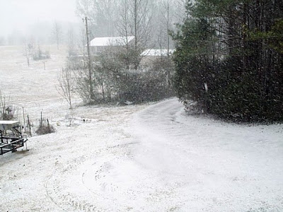
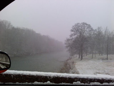
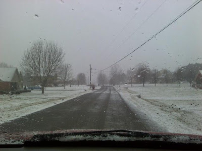
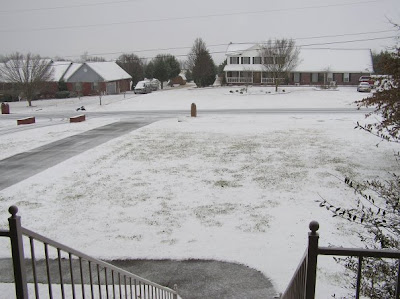
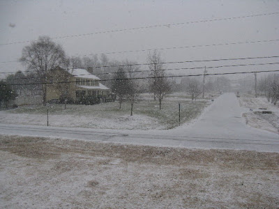
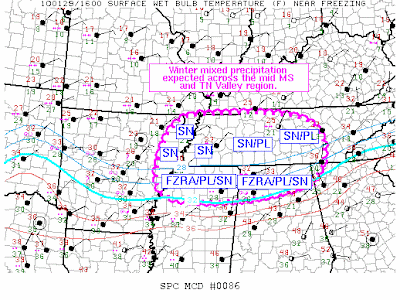
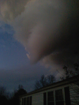
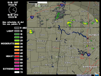
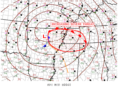
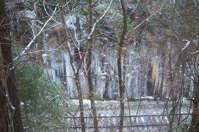
It may not seem like a major cold wave to people in other parts of the world or other parts of the U.S., but the State of Alabama is in the middle of a potentially dangerous and historic cold wave. The coldest weather and possible frozen precipitation is yet to come.

At my location in NE Huntsville, Alabama, the last temperature above freezing occurred between 3 p.m. and 4 p.m. on Friday January 1, 2010. Temperatures have been at or below freezing now for over 72 consecutive hours, or three full days. As the sun sets this evening, the temperatures will plummet back through the twenties and into the teens, adding to our consecutive hour freezing streak.

The low at my location on Saturday January 2 was 20.3, but my low for January 2 actually occurred just before midnight when the temperature dropped to 18.

My low on Sunday January 3 was 16.9 and the afternoon high was 32.0.

This morning's low was 16.3.

---

Let's take a look at a few statistics covering the first 72 hours (three days) of this cold wave in Huntsville. Over the past 72 hours, the NWS web site has published 214 official temperature readings that were observed at the Huntsville-Madison County Executive Airport.

Temperatures have ranged from 16 to 32.

Over those 72 hours and 214 observations:

The average temperature was 22.6.
The median temperature was 22.
The mode (most frequently occurring temperature) was 19.
Temperatures have been observed at 30-32 for 3 out of the 214 observations.
Temperatures have been below 20 on 64 of the 214 observations.

Alabamians should make sure their elderly and vulnerable neighbors have an adequate and safe source of heat. Pets should be moved to warm shelter. Measures should be taken to protect plumbing and plants.

Keep warm and throw another log or two on the fire.

...
Newer Posts Older Posts Home