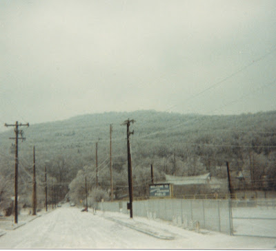
January 1966 was one of the coldest months in Alabama history and the last week of January 1966 was particularly brutal with temperatures 18-21 degrees below average. The NOAA Monthly Weather Review shows that on the map below.
 |
| January 1966 NOAA Monthly Weather Review |
This cold air was attributed to a strong ridge in the Northwest United States, extending to Alaska. This, in conjunction with a trough in the eastern half of the U.S., forced a series of shots of polar air southward. Adding to the mix was an unusual amount of snow cover. On the 29th, 6-11" of snow was on the ground across North Alabama. This set the stage for some all time records to be in jeopardy, including the all-time coldest temperature recorded in Alabama.
 |
| NOAA Climatological Data, January 1966 |
Alabamians awakened to the following low temperatures on the morning of January 30th:
-27F in New Market (Madison County) ***
-24F in Russellville (Franklin County)
-19F in Belle Mina (Limestone County)
-19 in Haleyville (Winston County)
-19F in Hamilton (Marion County)
-17F in Athens (Limestone County)
-17F in Haleyville (Marion County)
-14F in Double Springs (Winston County)
-14F in Madison (Madison County)
-12F at Redstone Arsenal (Madison County)
-11F in Vernon (Lamar County)
-11F in Valley Head (DeKalb County)
-11F in Huntsville (Madison County)
-10F in Moulton (Lawrence County)
-9F at Sand Mountain Substation (DeKalb County)
-9F in Scottsboro (Jackson County)
-8F in Red Bay (Franklin County)
-8F in Florence (Lauderdale County)
-7F in Bridgeport (Jackson County)
-6F in Muscle Shoals (Colbert County)
-6F in Albertville (Marshall County)
-5F in Fayette (Fayette County)
-5F in Waterloo (Lauderdale County)
-5F in Pinson (Jefferson County)
-5F at Saint Bernard (Cullman County)
-4F in Falkville (Morgan County)
-4F in Guntersville (Marshall County)
-4F in Oneonta (Blount County)
-4F in Birmingham (Jefferson County)
-4F in Heflin (Cleburne County)
-3F in Calera (Shelby County)
-3F in Decatur (Morgan County)
-2F in Bessemer (Jefferson County)
-2F in Gadsden (Etowah County)
-2F in Lafayette (Chambers County)
-2F in Rockford (Coosa County)
-2F in Pell City in St. Clair County)
-2F at Bankhead Lock and Dam (Tuscaloosa County)
-1F in Talladega (Talladega County)
-1F in Alexander City (Tallapoosa County)
0F in Clanton (Chilton County)
0F in Anniston (Calhoun County)
0F in Auburn (Lee County)
1F in Sylacauga (Talladega County)
1F in Childersburg (Talladega County)
1F in Thorsby (Chilton County)
2F in Ashland (Clay County)
2F in Aliceville (Pickens County)
2F in Centreville (Bibb County)
2F in Prattville (Autauga County)
3F in Marion Junction (Dallas County)
3F in Eufaula (Barbour County)
4F in Tuskegee (Macon County)
4F in Union Springs (Bullock County)
5F in Montgomery (Montgomery County)
4F in Clayton (Barbour County)
4F in Highland Home (Crenshaw County)
4F in Ozark (Dale County)
4F in Troy (Pike County)
5F in Selma (Dallas County)
5F in Hayneville (Lowndes County)
5F in Greenville (Butler County)
6F in Whatley (Clarke County)
6F in Thomasville (Clarke County)
6F in Tuscaloosa (Tuscaloosa County)
6F in Demopolis (Marengo County)
6F in Livingston (Sumter County)
6F in Brantley (Crenshaw County)
6F in Camden (Wilcox County)
6F in Enterprise (Coffee County)
6F in Frisco city (Monroe County)
7F in Natchez (Monroe County)
7F in Headland (Henry County)
7F in Andalusia (Covington County)
7F in Chatom (Washington County)
8F in Atmore (Escambia County)
8F in Gilbertown (Choctaw County)
9F in Geneva (Geneva County)
9F in Evergreen (Conecuh County)
9F in Brewton (Escambia County)
9F in Fairhope (Baldwin County)
9F in Bay Minette (Baldwin County)
10F in Dothan (Houston County)
10F in Robertsdale (Baldwin)
11F in Coden (Mobile County)
13F in Mobile (Mobile County)
14F at Fort Morgan (Baldwin County)
At the time it was reported that the coldest temperature was -24F in Russellville, but that was in error. It was the only time I have ever heard that an Alabama community reported the coldest temperature in the United States. Alabama State Climatologist Dr. John Christy interviewed the observer who reported the -27F reading in New Market in 1988. She explained why the original report of -17F was changed to -27F.
*** "Ms. Lucille Hereford of New Market in Madison County was town postmistress and served as the volunteer weather observer. Every morning she faithfully checked the high and low temperature, and the precipitation. I interviewed Ms. Hereford by phone in 1988 to get her story. She remembered that the sun was out on the morning of Jan. 30, 1966, and the ground was covered with 8" of new snow (Huntsville measured 7.3"). It was terribly cold. She walked out to the instrument shelter and opened the door. She couldn’t believe what she saw so she called an acquaintance who happened to be trudging by and asked him to read the little indicator that rested at the coldest temperature since it was reset the day before. He said it looked like -28° Fahrenheit, but she thought it was closer to "only" 27 below. Since she was the official reader, the observation was reported as -27° F – Alabama’s coldest ever recorded temperature. The official story has a twist: For some reason the value was officially recorded as -17° that morning, not -27°. That was a bit warmer than the -24° F reported at Russellville that day."
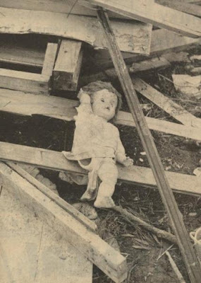
According to NOAA Storm Data for January 1966, the snow and record cold of January 29-31, 1966 was responsible for 10 deaths, five injuries, and extensive damage to utility lines, water pumps, water lines, and automobiles. There was an extensive loss in poultry production.
 |
| Special Weather Summary by State Climatologist C.C. Wooden |
Alabama has had a handful of other extreme cold waves in 1899, 1940, and 1985, but the extreme temperatures in isolated pockets of North Alabama were the coldest ever recorded in this state.
Sources:
NOAA Monthly Weather Review January 1966
NOAA Storm Data 1966
Alabama Climate Report December 2010 Dr. John Christy
Climatological Data, January 1966, NOAA, Environmental Data Service
---