5/30/10 & 5/31/10 Memorial Day Weekend Skies in North Alabama:
6/02/10 NE Huntsville, AL Thunderstorm Time Lapse:
6/4/10 Oil spill Reaches Alabama Beaches
A man was struck by lightning 6/4/10 near Ripley in Limestone Co, AL. He was injured and will live. A reminder to seek shelter.
6/9/10 - My report to the NWS Huntsville: RT @stormreports: Madison County, AL - 60 mph wind gust estimated by spotter near chapman middle school in northeast huntsville6/09/10 - Huntsville, AL Severe Thunderstorm Video:
6/13/10 NE Huntsville Sky Time Lapse:
6/14/10 - At 11 a.m. it was 97F on my car thermometer in Decatur, AL. Heat index 105F at 11 a.m. at Huntsville International Airport.
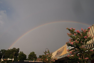
6/16/10 - Skies just NE of Huntsville, AL at 5:33 p.m.:

6/16/10 Huntsville, AL Sky Time Lapse:
6/17/10 Outflow Boundary on Radar:
6/17/10 - Decatur, AL Convection Time Lapse:
6/19/10 - Amazing shelf cloud just rolled through Madison, AL. Flooding on I-565 west of Madison:

6/19/10 - Madison, AL Shelf Cloud Time Lapse:


