The biggest question is whether this will be a severe thunderstorm and straight line wind event with a few small tornadoes or a major tornado outbreak. Some of the ingredients are there for tornadoes. It appears right now that the amount of destabilization out ahead of the front may preclude this from being a major tornado outbreak. The big question will be how much moisture can advance northward ahead of the front.
Usually in a major tornado outbreak, supercells form ahead of the main line and produce violent tornadoes. If there is not enough moisture ahead of the front, the storms advance in a linear fashion, or perhaps in a broken line. In this set up, tornadoes are still possible, but usually not as large, numerous, or damaging.
Having said all of this, it is still a bit early to make a final call on the situation and all residents should be weather aware on Wednesday. If you do not currently own one, this would be an ideal time to purchase a NOAA Weather radio.
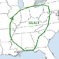
Here is an excerpt from the Storm Prediction Center this morning.
GIVEN THE STRENGTH OF EXPECTED FORCING THROUGH THE OHIO AND
TENNESSEE VALLEYS...AND THE STRENGTH OF THE LOW-LEVEL AND DEEP
LAYER    SHEAR THROUGH MUCH OF THE EASTERN U.S...THE MAGNITUDE
OF WARM SECTOR DESTABILIZATION APPEARS TO BE THE MAIN UNCERTAINTY
CONCERNING THE    POTENTIAL FOR A MUCH MORE SIGNIFICANT SEVERE
CONVECTIVE EVENT.     FORECAST SOUNDINGS INDICATE THE
NORTHEASTWARD ADVECTION OF AN    ELEVATED MIXED LAYER ACROSS
THE WARM SECTOR THAT COULD PRECLUDE...OR    AT LEAST LIMIT...PRE-
FRONTAL STORM DEVELOPMENT ...AND ALLOW FOR THE    REALIZATION
OF ONLY VERY WEAK CAPE--ON THE ORDER OF A FEW HUNDRED J/KG--WHERE
THE FRONT STRONGLY FORCES CONVECTIVE DEVELOPMENT.  WHILE
THIS COULD MINIMIZE POTENTIAL FOR HAIL...AND PERHAPS THE RISK FOR
TORNADOES...AN APPRECIABLE RISK FOR DAMAGING WIND GUSTS APPEARS TO
EXIST WITH AN ANTICIPATED FRONTAL SQUALL LINE    WEDNESDAY...
PARTICULARLY ACROSS KENTUCKY/TENNESSEE...PARTS OF    INDIANA AND OHIO.

...


No comments:
Post a Comment