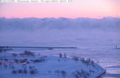
Milwaukee, Wisconsin at 7 am this morning - NOAA
The coldest weather in many years is pouring down across the United States. The worst of it began to enter North Alabama overnight. We have had colder mornings so far this winter, but this is the beginning of what is likely to be the coldest air in at least six years. The temperature dropped to the freezing point at Midnight overnight (Wednesday night/Thursday morning) and it will stay below freezing until at least Saturday. As of 6:52 this morning, the temperature had dropped to 18.1. (7:17 update -17.6 degrees). Here is how observations went this morning at my location:
1/14/09
(23:58:03) 33 here in Hsv…
(23:59:07) I guess this is the last time I rept a temp above freezing for a few days…..
1/15/09
(04:50:30) 21.6 Here in NE Huntsville at the foot of Monte Sano.
(06:02:40) 19.2 here in NE Huntsville(06:35:35) 18 now in NE Huntsville
(06:36:03) Wind chill at the HSV Skycam is 3, per Jason Simpson
(06:36:30) Temp at Skycam 19
---
Latest HWO from NWS Huntsville NWS:
HAZARDOUS WEATHER OUTLOOK
NATIONAL WEATHER SERVICE HUNTSVILLE AL
500 AM CST THU JAN 15 2009

ALZ001>010-016-TNZ076-096-097-151930-
LAUDERDALE-COLBERT-FRANKLIN AL-LAWRENCE-LIMESTONE-MADISON-MORGAN-
MARSHALL-JACKSON-DEKALB-CULLMAN-MOORE-LINCOLN-FRANKLIN TN-
500 AM CST THU JAN 15 2009

THIS HAZARDOUS WEATHER OUTLOOK IS FOR NORTH ALABAMA AND PORTIONS OF
SOUTHERN MIDDLE TENNESSEE.

.DAY ONE...TODAY AND TONIGHT...

THE COLDEST AIR IN NEARLY SIX YEARS WILL BE MOVING INTO THE AREA
TODAY...WITH HIGH TEMPERATURES REMAINING BELOW FREEZING. A DANGEROUS
WIND CHILL POTENTIAL IS EXPECTED THIS TONIGHT...AS TEMPERATURES
AFTER DUSK TUMBLE THROUGH THE TEENS...WITH SUSTAINED NORTHERLY WINDS
OF 10 TO 15 MPH. THIS WILL PRODUCE WIND CHILL READINGS RANGING FROM
ZERO TO -10 DEGREES. EVEN COLDER CONDITIONS ARE POSSIBLE IN THE MORE
EXPOSED HIGHER TERRAIN.

.DAYS TWO THROUGH SEVEN...FRIDAY THROUGH WEDNESDAY...

THE VERY COLD WEATHER WILL CONTINUE...WITH AIR TEMPERATURES EXPECTED
TO REMAIN BELOW FREEZING UNTIL SATURDAY AFTERNOON. PRECAUTIONS FOR
COLD WEATHER CONDITIONS...SUCH AS COVERING PIPES AND PROTECTING
PETS...SHOULD BE COMPLETED QUICKLY.

.SPOTTER CALL TO ACTION STATEMENT...

ACTIVATION OF STORM SPOTTERS AND EMERGENCY MANAGEMENT PERSONNEL IS
NOT ANTICIPATED AT THIS TIME.

$$

RSB


2 comments:
Amazing that the cold air is reaching all the way down into the Deep South!
The lowest temp in Wisconsin this morning was -37 in New Post, Sawyer County. Windchill warnings across the entire state have been in effect since yesterday and run until noon tomorrow for windchills down to -50 F.
Doubt you'll see numbers that low ;)
I've now measured 62 consecutive hours below zero, with another 24 ahead of us. Unfortunately, a repeat of this is possible towards the end of next week!
Stay warm!!
Wow, we are such wimps! I don't see how you function.
Post a Comment